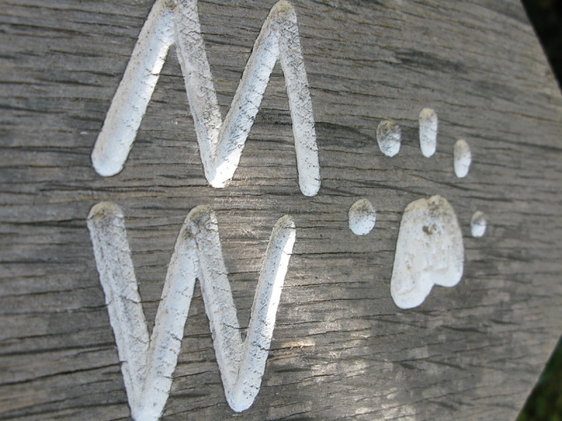
Two Moors Way on Exmoor, Lynmouth, Exmoor National Park
[Main photo: Two Moors Way signpost on Exmoor]
Long distance path running across Exmoor, Mid Devon and Dartmoor with an extension to the South Devon coast
The Two Moors Way is a long distance path that runs from Lynmouth on the Exmoor National Park coast all the way south to Ivybridge on the southern border of Dartmoor National Park. At over 100 miles, it's a long way but, clearly, one can dip into the walk at various points.
This listing covers the Two Moors Way in Exmoor National Park, Mid Devon, Dartmoor National Park and South Devon.
We'd recommend continuing on the Erme-Plym Trail to Wembury which is the southern end of the Coast to Coast Path.
We walked the Two Moors Way, north to south, and the Erme-Plym Trail over a longer period of time so you don’t have to do it all in one hit.
Exmoor National Park
In Exmoor National Park, when walking north to south, the Two Moors Way runs from Lynmouth to Simonsbath to Hawkridge before leaving the national park on its way to Withyridge in Mid Devon.
Lynmouth to Simonsbath
Start by the 2017 ‘The Walker’/Lynmouth Two Moors Way Statue on the seafront opposite Lynmouth Pavilion National Park Centre and Lynton and Lynmouth Cliff Railway. There are lots of cafes/shops for tea/coffee before you go. There are loos in Lynmouth Pavilion National Park Centre.
Follow the side of the River Lyn to the main bridge in the centre of the village. You see Glen Lyn Gorge across the road by the A39. Walk the right hand side of the A39 opposite Lynmouth’s main car park. There’s a raised walkway and a marker stone down to your right that guide you up a narrow and increasingly steep lane that turns into a path that climbs sharply through Lyn Cleave to open land. This section is steep and tiring so it’s a relatively difficult start. The views from up top are superb.
Follow a path along the top of the hill with views behind to Lynmouth, the Bristol Channel and South Wales and east into the remarkable wooded valley cut by the River Lyn. Continue on the path at the top of the hill. It dips down to cross a stream and then arcs around into woods. The path then connects with the A39 again.
Walk for a few hundred metres along the A39 and you’ll see a National Trust sign to your right with Two Moors Way waymarkers nearby. You come to a large car park. From there, the path pretty much follows the valley floor before curling around to the hamlet Scoresdown and then climbing to the edge of the high moor.
Walking Exmoor’s high moor. You pass through a gate and high moor opens out in front of you. There’s a farm track to the left, a path to the centre and a path to the right. Follow the central path across Cheriton Ridge. Refer to Ordnance Survey mapping for detail. You’re crossing exposed moorland. There’s a beautiful valley ahead to which the path leads. You come to a wall. Cross it and drop down to a bridge that spans the water. Turn right and then head up the hill and very shortly you’ll see the path to your left running along the lower valley wall. Detour to the standing stones before crossing the ford and climbing to the gate below Exe Head.
It’s then a short walk across high moor to a wall and then a gate by the B3223. There’s a super view down the River Exe valley at this point.
Walk past the car parking area and along the road. There’s a gate to your left. Wander across the moor until you come to another gate. Descend to Ashcombe Plantation and you come to the car parking area at Simonsbath. Go to the pub. Exmoor Forest Inn is in the heart of Simonsbath.
Simonsbath to Hawkridge
Start from the Exmoor Forest Inn. Wander south down the road in the direction of Simonsbath Bridge and you’ll see a Two Moors Way sign that directs you to a path running down the east side of the River Barle. The path is flat and the walking easy. This beautiful, steep-sided valley leads to Cow Castle which is an Iron Age hillfort. The views as you approach Cow Castle are stunning.
Walk around the east side of the hillfort and through a plantation until you come to open moor where the path climbs above the River Barle and the Exmoor beauty spot Landacre Bridge.
You cross Landacre Lane and follow a skinny moorland road called Kitridge Lane down into Withypool. Stop at Withypool Post Office, Off-licence and General Stores or Withypool Tea Rooms or Withypool The Royal Oak Inn.
Follow the main road east out of Withypool over Mill Bridge and you’ll come to a Two Moors Way sign. Once again walk the east side of the River Barle past stepping stones and sign (‘Take Care Stepping Stones Can be Slippery’) and you enter a glorious stretch of woodland and then Tarr Steps National Nature Reserve. A sign reads ‘Welcome to Tarr Steps National Nature Reserve. The woodland and river host special wildlife including otters, salmon, birds such as dipper and kingfisher and also rare mosses and lichen’. Keep dogs out of the river in salmon migration and spawning season (August to December).
The Two Moors Way follows the River Barle down to the famous Tarr Steps. Stop at Tarr Farm Inn. Cross the River Barle on the ancient clapper bridge and then there’s a steep climb towards Parsonage Farm and along the edge of a wood to Hawkridge.
Hawkridge to Withyridge
Follow the road running south west from Hawkridge. You’ll see Two Moors Way signs at West Hollowcombe that direct you across a field to Saddle Lane. Walk the lane to a signpost directing you across Anstey Money Common. The path rises steeply across open moor and provides great views back from where you came. You’ll pass by a trig point 356 metres above sea level and West Anstey Barrows before crossing a road to Woodland Common and the southern border of Exmoor National Park.
Look right to see Peter Randall-Page’s IIMW sculpture. This is one half of a sculpture. The second half is on the northern border of Dartmoor National Park. The two sections of the sculpture face one another across Mid Devon.
You are now leaving Exmoor National Park and walking across Mid Devon.
Head south along Badlake Lane to West Anstey. You then walk country lanes and follow paths across fields to get to Witheridge. Whilst there’s a lot of walking on country lanes in this section, we encountered little traffic. You pass under the very busy A361 at Knowstone Inner Moor.
Mid Devon
In Mid Devon, when walking north to south, the Two Moors Way runs from the southern border of Exmoor National Park to Witheridge to Down St Mary before entering Dartmoor National Park just north of the pretty village Drewsteignton.
Witheridge to Down St Mary
The Two Moors Way heads south across fields to the B3042. Take care when crossing the road. It’s easy walking to Washford Barton before you head through Washford Wood on your way to Lower Black Dog near Black Dog. The Two Moors way trends south west to Morchard Bishop and Down St Mary.
Note that the trail passes east of Down St Mary. We walked the Two Moors Way in stages and parked there, hence its inclusion as a destination.
Down St Mary to Drewsteignton
Walk south from the Down St Mary area to Lammacott Farm. Take care crossing the busy A3072 (you have to walk a very small stretch of this fast road) and then continue to Paschoe House where the Two Moors Way splits from the Devonshire Heartland Way.
Walk south from Paschoe House. It’s then a section of country lanes and rolling Mid Devon hills to Hittisleigh Cross. It’s a beautiful, hilly walk to the border of Dartmoor National Park.
Crossing Dartmoor National Park's northern border on the Two Moors Way isn't the most inspiring experience. A bridge spans the A30 Exeter/Cornwall road and the Two Moors Way runs down a road to a farm. Pass through the farm and you're on an old track that takes you to the IIMW Sculpture. This faces north. There's another on the border of Exmoor National Park facing south. From the sculpture, continue along the track to West Mill Farm passing Secret Place on your way.
You come to a country road. Wander up the road to the pretty village Drewsteignton. There's a shop and pub.
Dartmoor National Park
In Dartmoor National Park, the Two Moors Way runs from the northern border of the national park to Chagford to Widecombe-in-the-Moor to Holne and then down Dartmoor’s south moor to the border village Ivybridge.
North border of Dartmoor National Park to Chagford
Head right, or west, out of the village and you'll see a waymarker. The Two Moors Way drops to a valley floor and then climbs very steeply through woods to a couple of large fields. Cross these and you are on the north lip of the sublime Teign Gorge.
A good path, known as the Hunter's Path, trends west to Sharp Tor which offers one of the finest views on the Two Moors Way and within Dartmoor National Park. You'll see the National Trust's Castle Drogo ahead of you above the mouth of the gorge. Dartmoor's north plateau forms the horizon. Between, below Meldon Hill, is the very popular town Chagford which is where you are off to now.
Leave Sharp Tor and walk the path down to Iron Bridge. Follow the River Teign upstream to Dogmarsh Bridge and past Granite Song sculpture to a long stretch of fields. You'll see Chagford and Meldon Hill in front of you. Chagford has lots of pubs, cafes and shops.
Chagford to Widecombe-in-the-Moor
Chagford Swimming Pool is on the edge of town near Rushford Bridge. By that bridge, the Two Moors Way trends west along the River Teign to Chagford Bridge. Look out for kingfishers. At Chagford Bridge, you connect with a country road that rises towards the luxury hotel Gidleigh Park. Before you get to the turning for Gidleigh Park, across the river from the National Trust's Milfordleigh Wood, an old track climbs steadily towards Teigncombe. It connects with a country road. Wander past a cluster of pretty houses and the Two Moors Way leaves the road as it doglegs and runs through a pretty section of countryside on the fringe of the high moor.
Continue to Great Frenchbeer and Teignworthy. There's a steep descent to the South Teign River and a short, sharp ascent to Yardworthy. At this point, the Two Moors Way splits. An eastern branch follows the old Mariners' Way. We're going to stay on the central path as it leaves pretty countryside and climbs to moorland.
Wander up the road from Yardworthy towards Fernworthy Forest and you come to Chagford Common. The Two Moors Way rises south. Detour slightly to see Hurston Ridge/Chagford Common Stone Row. Turn around and Meldon Hill and Chagford are behind you. Beyond them are the National Trust's Castle Drogo and the Teign Gorge.
Towards Water Hill at the top of Chagford Common, the Two Moors Way bends and dips east to cross the busy B3212 trans moorland road. Note that the highest pub in southern England, the Warren House Inn, is just down the road. At this point, the Two Moors Way splits again. A western branch heads down to Yar Tor and onto the Dart Gorge. Once again, we're staying on the central path because it's the most beautiful and interesting of the routes.
Cross the B3212 to look at Bennett's Cross. The Two Moors Way very obviously climbs a very beautiful area of moorland near Birch Tor and then drops to another road just north of Headland Warren Farm. It's then a yomp up to Hookney Tor with its fabulous views of English Heritage's Grimspound. Drop down to Grimspound. Climb the moor to Hameldown Tor. You're now on a whaleback of moorland called Hamel Down. The views are sensational. Heather and gorse are gorgeous in late summer.
You pass numerous ancient burial mounds before descending gently to the Widecombe-in-the-Moor area where you'll find pubs, cafes and a shop as well as places to stay.
Widecombe-in-the-Moor to Holne
This section of the Two Moors Way connects north and south. From the moor above Widecombe-in-the-Moor, the Two Moors Way drops down to a country road. Divert to Hutholes Abandoned Medieval Settlement if interested. Follow the road to Jordan where a path takes you through a pretty woodland to Ponsworthy. A road climbs steeply north west and takes you to moorland. Wander south and you come to Dr Blackall's Drive on the north lip of the Dart Gorge.
Like the Teign Gorge, the views are sensational, especially in autumn when the trees turn. Dr Blackall's Drive descends to New Bridge which is next to a very famous wild swimming area called Spitchwick. You then ascend through woodland to Holne. There are pubs and places to stay around Holne and nearby Scoriton. You are now below the south moor.
Holne to Ivybridge
This reasonably long section takes you down Dartmoor's south moor. You follow the old trackbed of a disused railway for much of it so it's easy walking. From Holne and Scoriton, the Two Moors Way follows a track to Chalk Ford on the boundary of the moor. The views back along this track across Dartmoor to South Devon are superb.
At Chalk Ford, you climb over domed moorland and drop down to Huntingdon Warren Cross. Note the Avon Reservoir to the south. From Huntingdon Warren Cross, head for the clapper bridge that spans the River Avon. Yomp up the steep hill to the plateau. You'll see Red Lake China Clay Works and the start/end of the Red Lake Railway. This is remote high moor.
Follow the railway south. It goes on and on until you come to a big stone with the Two Moors Way waymarker. Descend to an old track and the southern border of Dartmoor National Park. You're at the edge of Ivybridge.
Ivybridge is the biggest destination on the Two Moors Way in Dartmoor National Park (on the southern border to be specific). There are plenty of shops, pubs and places to stay. We'd recommend continuing on the Erme-Plym Trail to Wembury which is the southern end of the Coast to Coast Path.
South Devon
In South Devon, the Two Moors Way becomes the Erme-Plym Trail and runs from Ivybridge to Yealmpton to Wembury on the South Devon coast just east of the Plymouth Sound. The Erme-Plym Trail connects with the South West Coast Path at Wembury.
Ivybridge to Yealmpton on the Erme-Plym Trail
Follow the River Erme south of Ivybridge to Ermington.
From Ermington the Erme-Plym Trail trends west to Yealmpton.
Yealmpton to Wembury on the Erme-Plym Trail
Head north west out of Yealmpton and the trail arcs to Brixton and then West Wembury. It’s then an easy walk down the pretty Churchwood Valley to Wembury and Wembury Bay.
There’s a great National Trust cafe overlooking the beach. Visit Wembury Marine Centre.
The Erme-Plym Trail and the South West Coast Path
As mentioned in the introduction to this listing, the Erme-Plym Trail connects with the South West Coast Path at Wembury. Walk west and you come to the stunning Yealm Estuary. Walk east and you come to Plymouth Sound. If you continue for about another 400 miles, you’ll be back where you started on the Exmoor coast at Lynmouth. It’s a great walk. Recommended :-)
Photo Gallery