Dunkery Beacon (National Trust), Porlock, Exmoor National Park
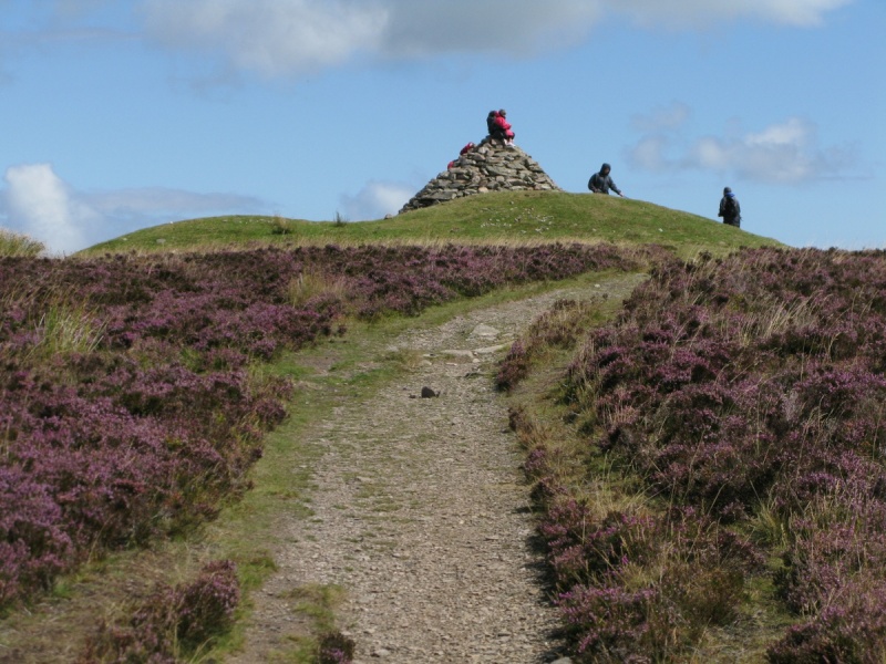
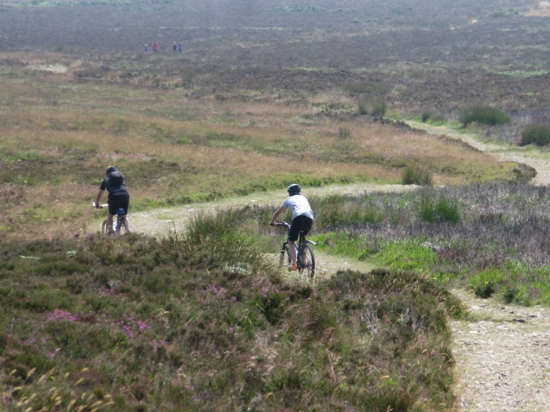
[Main photo: the beacon topping Dunkery Hill]
Dunkery Beacon (National Trust) is the highest point in Exmoor National Park
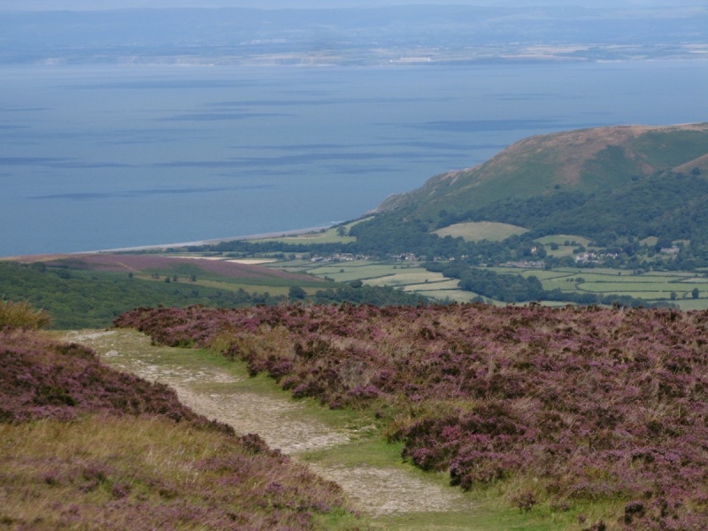
Dunkery Beacon is the highest point in Exmoor National Park. At 519 metres above sea level, it provides amazing 360 degree views of this part of the UK including Exmoor National Park, the Bristol Channel and South Wales.
Location of Dunkery Beacon (National Trust)
Dunkery Beacon is at the eastern end of Exmoor’s high moor above Horner Wood and Porlock Vale. Porlock is to the north. Wheddon Cross is to the south east. Exford is to the south west.
We’ve positioned Dunkery Beacon on Google maps. Zoom in on the ‘Satellite’ setting to see its location.
Directions to, and parking at, Dunkery Beacon (National Trust)
Given its location on high moor, you can approach Dunkery Beacon from most directions. We cover different routes and car parks in detail further down in this listing.
This is the easiest route up top. Head out of Wheddon Cross on the B3224 and you very shortly come to Blagdon Cross. Take the moorland road in front of you to Dunkery Gate and Dunkery Bridge. There's a small car parking area on your right. A good path rises to Dunkery Beacon. It's a short walk and isn't particularly demanding.
Again, we’ve positioned Dunkery Beacon on Google maps. Zoom in on the ‘Satellite’ setting to see its location.
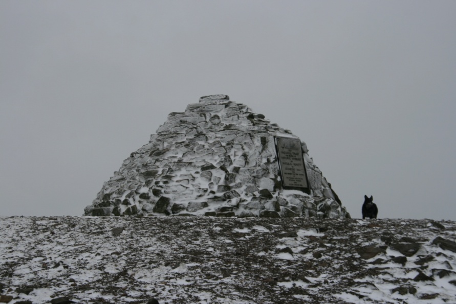
Dunkery Beacon (National Trust)
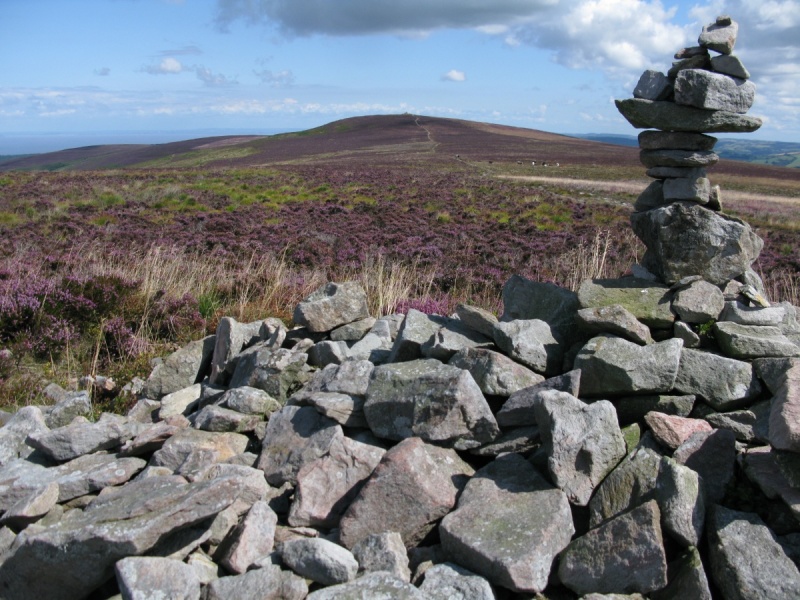
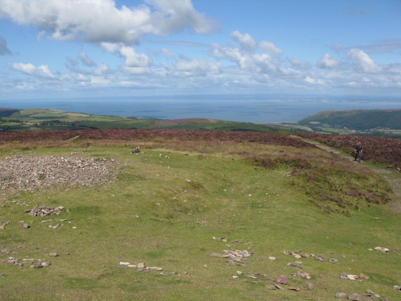
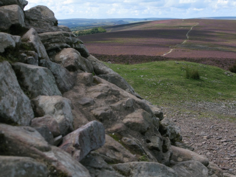
Dunkery Beacon tops Dunkery Hill at the eastern end of Exmoor’s high moor. The views are immense. On a clear day, you'll see Dartmoor National Park to the south and Bannau Brycheiniog/Brecon Beacons National Park to the north. Bodmin Moor is to the south west and the high ground of Exmoor National Path extends west. Highly recommended.
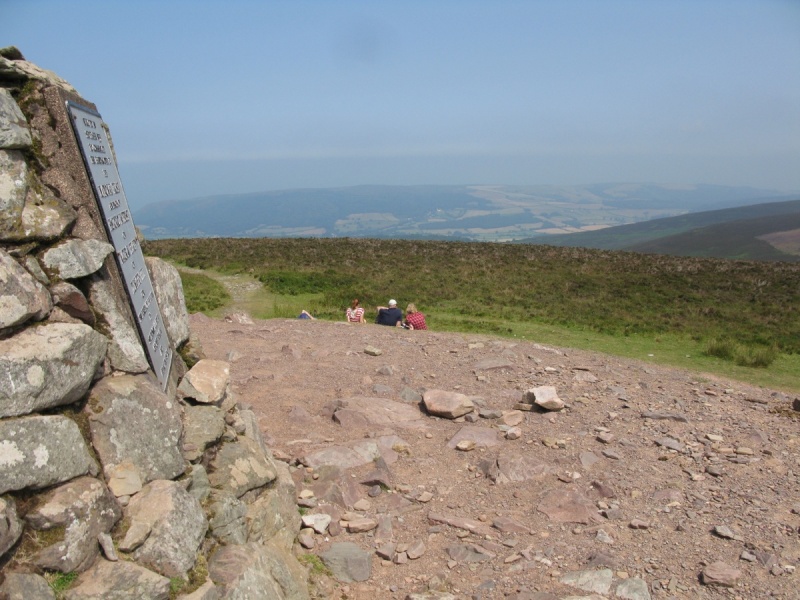
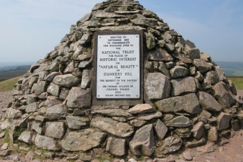
There’s a plaque on the beacon. This reads:
‘Erected in September 1935 to commemorate the handing over to the National Trust for places of historic interest or natural beauty of Dunkery Hill for the benefit of the nation by Sir Thomas Acland BT. Colonel Wiggin and Allan Hughes ESQ.’
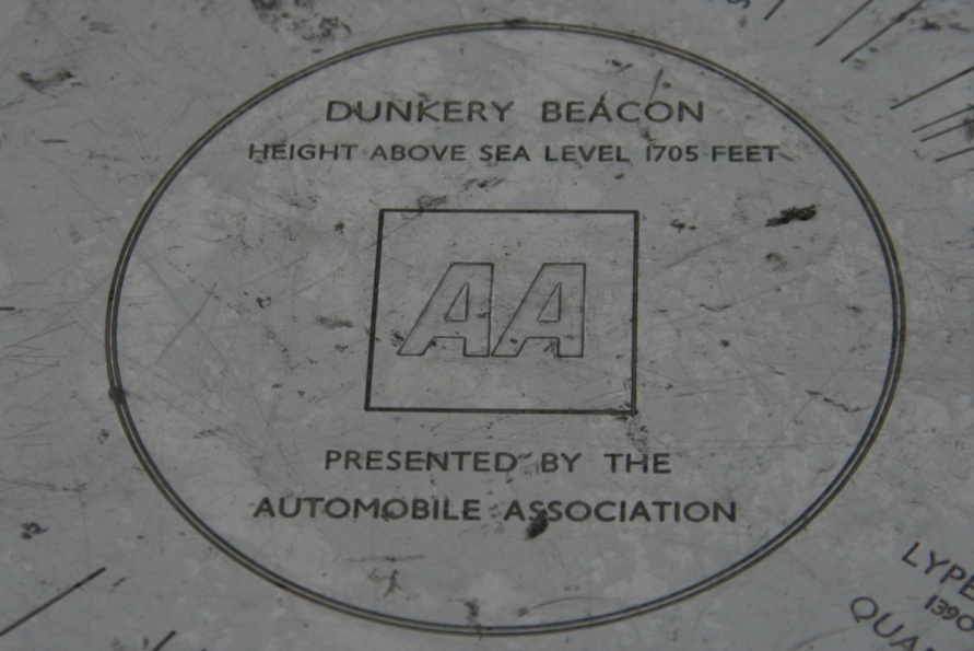
There’s a toposcope, or orientation table, near the beacon that provides information on the direction and distance of notable landscape features which can be seen from the point in ideal conditions. Running around the points of the compass, these are:
Ordnance Survey Grid North.
Nash Point 16M [This is on the South Wales coast south of Bridgend].
Sugar Loaf Mt 52M (NT) [A 596 metres hill in Bannau Brycheiniog/Brecon Beacons National Park. Sugar Loaf is part of The Black Mountains].
Selworthy Church 3 3/4M [Church in pretty National Trust village known for its green and thatched cottages].
R.A.F. St. Athan & Cardiff Airport 18 1/2M [Airport on South Wales coast west of Barry and south west of Cardiff].
Barry 21M [Town on South Wales coast].
Penarth 25M [Town on South Wales coast/Cardiff Bay].
Flat Holme 24 1/2M [Island in the Bristol Channel].
Steep Holme 23M [Island in the Bristol Channel].
Sand Point 29M (NT) [Point on the Somerset coast at Sand Bay and Weston-Super-Mare].
Brent Knoll 27 1/2M [A 137 metres hill in Somerset].
Blue Anchor 8 1/2M 9 [Village on West Somerset coast].
Hinkley Nuclear Pwr. Stn. 19 1/2M [Power station in West Somerset coast].
Lype Hill 1390 FT 4 1/2M [Highest point of the Brendon Hills in Exmoor National Park].
Quarme Hill 1265 FT 4M [Close to Lype Hill].
Winsford Hill (NT) 1404 FT 4 1/2M [Beautiful hill overlooking the pretty Exmoor village Winsford].
Cawsand Beacon Dartmoor 1799 FT 34M [Huge whaleback hill close to the northern border of Dartmoor National Park].
Yes Tor Dartmoor 2028 FT 37M [Second highest point on Dartmoor. Just north of the highest point, High Willhays].
Withypool Hill 1306 FT 5 1/2M [Hill above the pretty Exmoor village Withypool].
Withypool Common 1398FT 6M [Moor by Withypool Hill in the national park].
Rowbarrows 1674 FT 1M [Prehistoric barrows to the west of Dunkery Beacon. It’s a superb, short walk to the Rowbarrows that’s particularly impressive when the heather is out in August].
Porthcawl 22M. [Town to the north on the South Wales coast].
Ordnance Survey Grid North.
Dunkery Beacon height above sea level 1705 feet.
Recommended route to Dunkery Beacon (National Trust) for the first time
To visit Dunkery Beacon for the first time, we’d recommend walking up from one of the parking areas on Dunkery Hill that line the road that cuts across the high moor to/from Porlock. These are marked on Ordnance Survey mapping and are visible on Google’s satellite imagery.
For example, there’s a small car park at Dunkery Gate and Dunkery Bridge just south east of Dunkery Beacon. It’s a short, sharp walk up top.
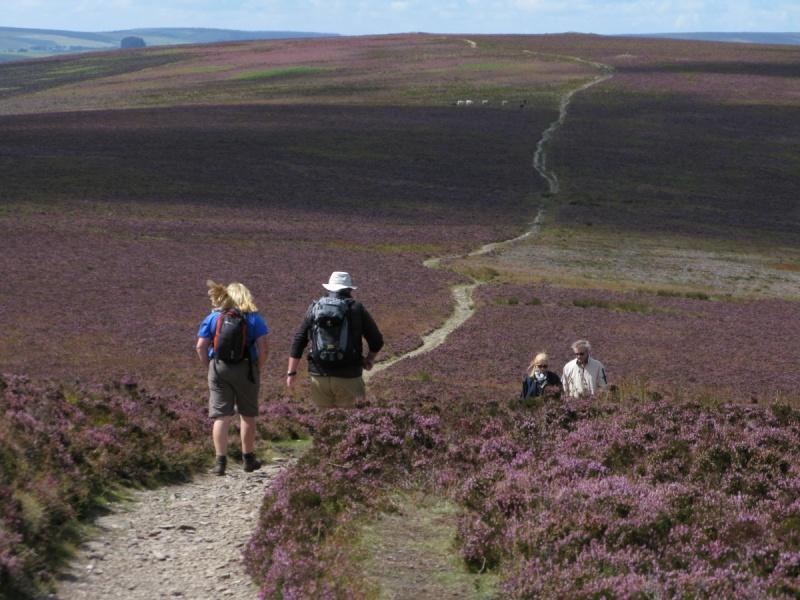
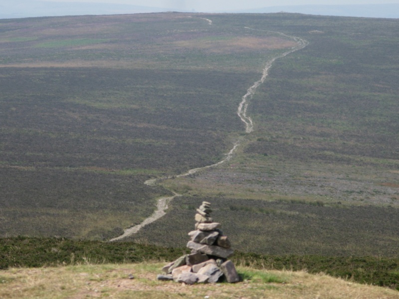
There’s another car park further north by the Macmillan Way West. Walk the track that crosses Dunkery Hill to Dunkery Beacon. Note that this track is pretty flat so it can be muddy after rainy spells.
Other routes and directions to Dunkery Beacon (National Trust)
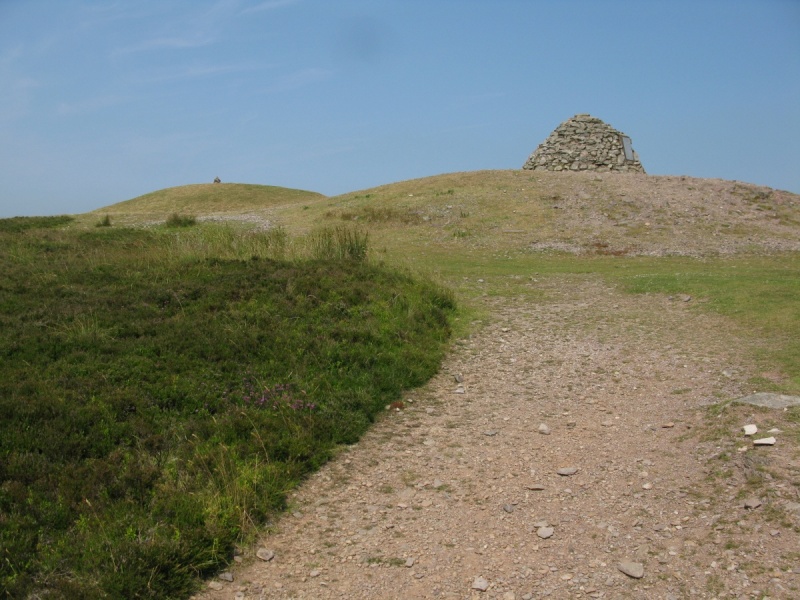
Dunkery Beacon tops Dunkery Hill. You can access this high ground from all directions.
Routes and directions to Dunkery Beacon (National Trust) from the west
Follow the Macmillan Way West from the west to Dunkery Beacon.
Alternatively, wander across open access moor to the Rowbarrows (Great Rowbarrow and Little Rowbarrow) and then walk along the track that rises to Dunkery Beacon. This is superb in August when the heather is out.
Routes and directions to Dunkery Beacon (National Trust) from the east
Follow the Macmillan Way West from the east to Dunkery Beacon.
Alternatively, start from Wheddon Cross and walk the Coleridge Way to the edge of Dunkery Hill. A path marked on Ordnance Survey mapping leads to Dunkery Gate and Dunkery Bridge and then Dunkery Beacon.
Routes and directions to Dunkery Beacon (National Trust) from the north
This is a superb direction from which to approach Dunkery Beacon.
Start from Webber’s Post and then take one of the many paths that run from the Horner Wood area up to Dunkery Beacon. It’s a bit of a slog but the walking and views are amazing. The various paths are marked on Ordnance Survey mapping.
Routes and directions to Dunkery Beacon (National Trust) from the south
Exford is to the south east. Various paths marked on Ordnance Survey mapping run from the village to the open access land at Exford Common and Hoar Moor.
Connect with the Macmillan Way West to Dunkery Beacon. Alternatively, wander across open access moor to the Rowbarrows (Great Rowbarrow and Little Rowbarrow) and then walk along the track that rises to Dunkery Beacon. Again, this is superb in August when the heather is out.
The views from Dunkery Beacon (National Trust)
Nash Point 16M [This is on the South Wales coast south of Bridgend].
Sugar Loaf Mt 52M (NT) [A 596 metres hill in Bannau Brycheiniog/Brecon Beacons National Park. Sugar Loaf is part of The Black Mountains].
Selworthy Church 3 3/4M [Church in pretty National Trust village known for its green and thatched cottages].
R.A.F. St. Athan & Cardiff Airport 18 1/2M [Airport on South Wales coast west of Barry and south west of Cardiff].
Barry 21M [Town on South Wales coast].
Penarth 25M [Town on South Wales coast/Cardiff Bay].
Flat Holme 24 1/2M [Island in the Bristol Channel].
Steep Holme 23M [Island in the Bristol Channel].
Sand Point 29M (NT) [Point on the Somerset coast at Sand Bay and Weston-Super-Mare].
Brent Knoll 27 1/2M [A 137 metres hill in Somerset].
Blue Anchor 8 1/2M 9 [Village on West Somerset coast].
Hinkley Nuclear Pwr. Stn. 19 1/2M [Power station in West Somerset coast].
Lype Hill 1390 FT 4 1/2M [Highest point of the Brendon Hills in Exmoor National Park].
Quarme Hill 1265 FT 4M [Close to Lype Hill].
Winsford Hill (NT) 1404 FT 4 1/2M [Beautiful hill overlooking the pretty Exmoor village Winsford].
Cawsand Beacon Dartmoor 1799 FT 34M [Huge whaleback hill close to the northern border of Dartmoor National Park].
Yes Tor Dartmoor 2028 FT 37M [Second highest point on Dartmoor. Just north of the highest point, High Willhays].
Withypool Hill 1306 FT 5 1/2M [Hill above the pretty Exmoor village Withypool].
Withypool Common 1398FT 6M [Moor by Withypool Hill in the national park].
Rowbarrows 1674 FT 1M [Prehistoric barrows to the west of Dunkery Beacon. It’s a superb, short walk to the Rowbarrows that’s particularly impressive when the heather is out in August].
Porthcawl 22M. [Town to the north on the South Wales coast].
Places to eat and drink near Dunkery Beacon (National Trust)
There are pubs at Wheddon Cross (Rest & Be Thankful Inn), Exford (The White Horse Inn/The Crown Hotel) and Porlock ( for example The Royal Oak/The Ship Inn).
There are tea rooms at Horner (Horner Tea Gardens) and Porlock.
Historical and cultural attractions near near Dunkery Beacon (National Trust)
Allerford Museum West Somerset Rural Life Museum and Victorian School.
Rowbarrows west of Dunkery Beacon. Explore some of Exmoor’s rich prehistory.
Further away, visit:
Minehead Harbour. Harbour in stunning location at the western end of Minehead Beach under North Hill. ‘There has been a harbour at Minehead since the late 1300s.’ (Source: Minehead Harbour website.)
Dunster Castle (National Trust). Impressive National Trust property dominating the beautiful village of Dunster.
Dunster Yarn Market, Butter Cross and Gallox Bridge (English Heritage). English Heritage properties in Dunster.
Cleeve Abbey (English Heritage). Wonderful English Heritage property just east of Exmoor National Park.
The Ancient Mariner Sculpture in Watchet. The Watchet and Quantock Hills National Landscape area inspired Samuel Taylor Coleridge to write ‘The Rime of the Ancient Mariner’.
Coleridge Cottage (National Trust). Visit the cottage in which Coleridge lived and wrote some of his most famous poetry. William Wordsworth lived, briefly, nearby.
Doone Valley/Doone Country. Richard Doddridge Blackmore's famous novel 'Lorna Doone' is set on Exmoor. Roughly speaking, Doone Valley/Doone Country runs south of Malmsmead and Oare along Badgworhty Water. It’s surrounded by high moor. Great walking.
Gardens near Dunkery Beacon (National Trust)
Selworthy Green (National Trust). 'There has been a village here since medieval times, but the current cottages were designed by Sir Thomas Dyke Acland in 1828 to create attractive homes for estate pensioners. Beyond the church (14th century), you'll find the village green, surrounded by warm yellow thatched cottages. Notice the tall chimneys which helped to draw the fire and carry sparks away from the thatch.' (Source: information board at Selworthy.)
Further away, visit:
Minehead Blenheim Gardens. Popular gardens behind the Esplanade and North Road at the western end of Minehead Beach.
Dunster Gardens, Dovecote and Tithe Barn. Gardens in the centre of Dunster village.
Dunster Castle (National Trust). The castle is surrounded by many gardens and heavily wooded walkways. The Keep Garden tops the hill on which the castle sits. Lawn’s Bridge, Marshall’s Bridge and Lovers’ Bridge span the River Avill on the eastern side of the castle.
Knightshayes (National Trust). Impressive gardens just off the A396 between Exmoor National Park and Tiverton.
Cothay Manor. Again, gardens outside the national park near Wellington and the M5.
Hestercombe House & Gardens. Gardens located just south of the Quantock Hills National Landscape near Taunton and the M5.
If you don’t mind the drive, RHS Garden Rosemoor by Great Torrington south west of Exmoor National Park is magnificent.
Other attractions near Dunkery Beacon (National Trust)
Porlock Beach. Big rock and pebble beach at the western end of Porlock Bay.
Porlock Weir Harbour. Beautiful harbour with pub and hotel.
West Somerset Railway. Heritage railway running between Minehead and Bishops Lydeard.
Dunster Estate (The Crown Estate). Home to England’s tallest tree. Great for walks and views. Wander up to Conygar Tower.
Dunster Beach. Massive low tide sand and stone beach.
Villages and towns near Dunkery Beacon (National Trust)
Horner village. Another beautiful Exmoor village at the bottom of Horner Wood by Horner Water. Enjoy a cream tea at Horner Tea Gardens.
Luccombe. Village not far from the viewpoint and large car park at Webber’s Post with thatched cottages like those at Selworthy.
Selworthy village. One of the West Country’s prettiest villages, Selworthy is famous for its thatched cottages and village green. Enjoy a cream tea at the Periwinkle Tea Room.
Allerford village. Beautiful village further inland known for its packhorse bridge.
Bossington. Village by Bossington Beach below Bossington Hill.
Porlock. Famous West Country village in Porlock Vale.
Porlock Weir. Amazing coastal village with harbour, pub, hotel and beach.
Minehead. Popular West Country resort town with huge beach and harbour. The start/end of the South West Coast Path.
Dunster. Essential visiting. Beautiful village dominated by Dunster Castle (National Trust) with English Heritage properties, Dunster National Park Visitor Centre and plenty of shops and places to eat and drink. Park of Dunster Estate (Crown Estate) with England’s tallest tree and super walk and views.
Photo Gallery