Porlock Shingle Ridge, Porlock, Exmoor National Park
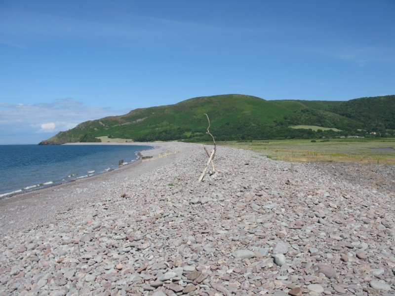
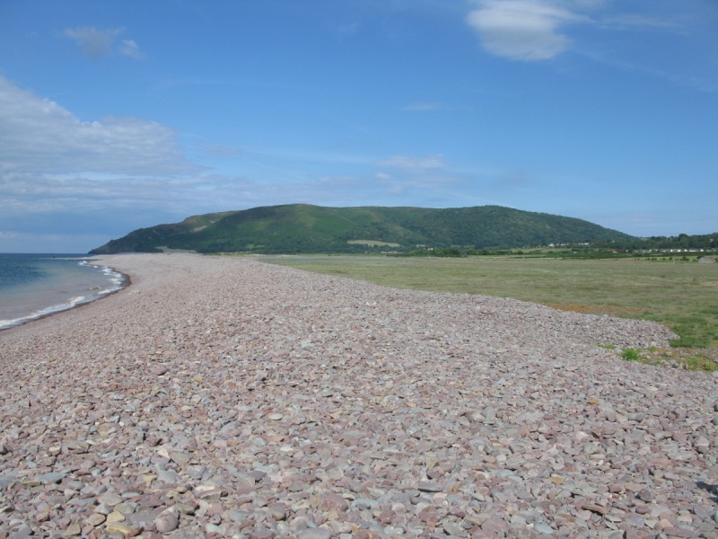
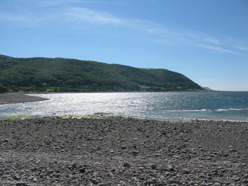
[Main photo: Porlock Shingle Ridge viewed from Bossington Beach. Porlock Marsh (National Trust) / Sparkhayes Marsh (National Trust) to the left. Porlock Weir ahead below Worthy Wood]
Porlock Shingle Ridge
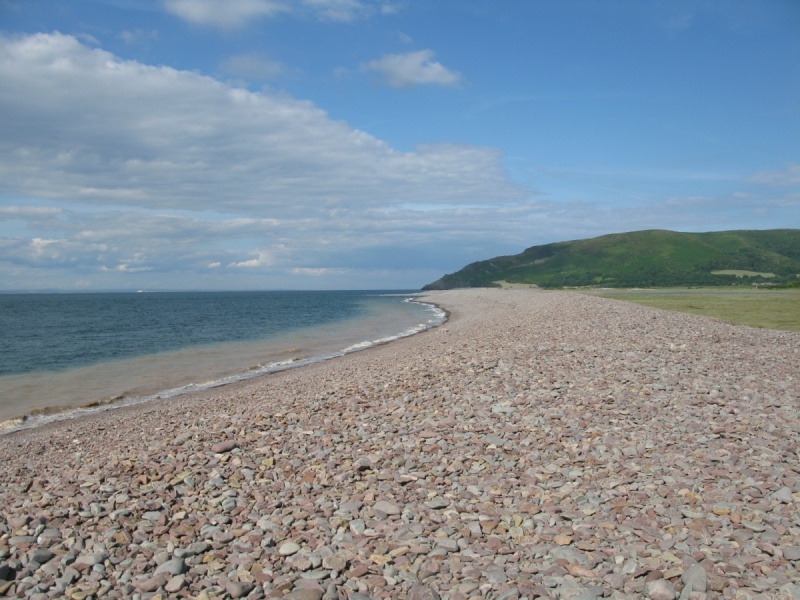
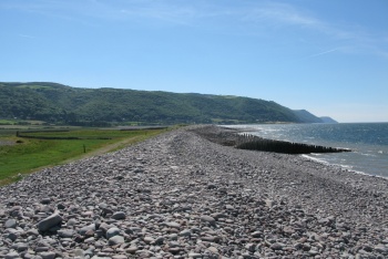
Porlock Shingle Ridge is a pebble and shingle ridge that lines the back of Bossington Beach and Porlock Beach in Porlock Bay. It’s part of the Porlock Ridge and Saltmarsh SSSI/Site of Special Scientific Interest. Porlock Marsh (National Trust) / Sparkhayes Marsh (National Trust) extends inland behind the ridge to Porlock and Porlock Vale.
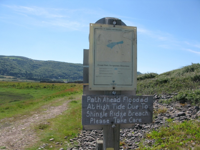
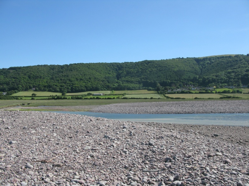
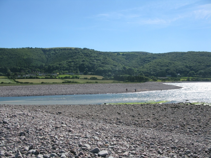
Porlock Shingle Ridge has been breached by the sea so there’s a large gap towards the western end near Porlock Weir. This is impassable. You have to follow the South West Coast Path across the saltmarsh to explore both sections of the ridge. See below for more information.
Location of Porlock Shingle Ridge
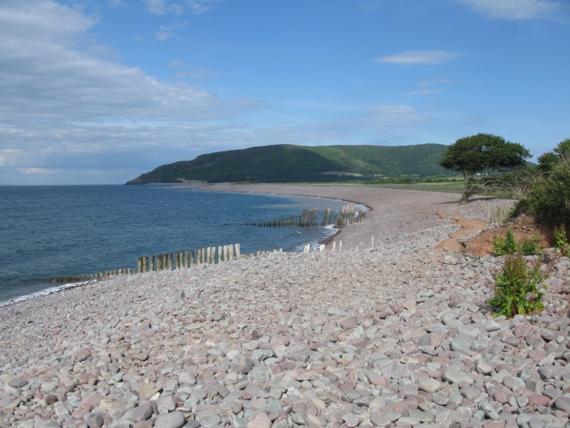
Porlock Bay is at the eastern end of the Exmoor coastline. An arc of rock and pebbles runs from Gore Point in the west to Hurlstone Point in the east. These rocks and pebbles back up to form Porlock Shingle Ridge. Porlock Beach is at the western end of the ridge by Porlock Weir. Bossington Beach at the eastern end of the ridge near Bossington.
We've positioned Porlock Shingle Ridge on Google maps. Zoom in on the 'Satellite' setting to see its location.
Directions to, and parking at, Porlock Shingle Ridge
Drive the A39 to Porlock. Follow one of the paths that runs across Porlock Marsh (National Trust) / Sparkhayes Marsh (National Trust) to get to the ridge. These paths are marked on Ordnance Survey mapping, eg Sparkhayes Lane.
Alternatively, drive to Porlock Weir or Bossington and wander across to see the ridge and beaches. Again, paths are marked on Ordnance Survey mapping. There are car parks at both Porlock Weir and Bossington.
Porlock Shingle Ridge
Porlock Beach and Bossington Beach are long rock and pebble beaches below Porlock Shingle Ridge.
‘Porlock shingle ridge was formed, as sea level rose during the middle part of the Holocene epoch, from shingle eroded from head deposits which masked the sea cliffs to the west after the last glacial period.’ (Source: Natural England Porlock Ridge and Saltmarsh SSSI citation on Natural England’s website.)
‘In recent years the shingle ridge to the east of Porlock Weir has been breached by the sea, leading to changes to the habitat of Porlock Marsh. Despite this, the ridge remains a classic example of a drift beach with pebbles becoming smaller as they are rolled towards Hurlstone Point. It is an important refuge for migrating and storm driven birds. (Source: information board at Porlock Weir car park.)
Porlock Ridge and Saltmarsh SSSI/Site of Special Scientific Interest
Porlock Shingle Ridge is part of the Porlock Ridge and Saltmarsh SSSI/Site of Special Scientific Interest which lines Porlock Bay from Gore Point in the west to Hurlstone Point in the east (roughly 4.5km/3m in length) and covers the saltmarsh that sits behind Porlock Shingle Ridge.
The Natural England Porlock Ridge and Saltmarsh SSSI citation provides an excellent description of the area:
'This site comprises a shingle ridge and associated saltmarsh hinterland extending for a distance of approximately 4 kilometres along the west Somerset coast, immediately north of Porlock village. Porlock shingle ridge was formed, as sea level rose during the middle part of the Holocene epoch, from shingle eroded from head deposits which masked the sea cliffs to the west after the last glacial period. This major source of coarse sediment has long since disappeared, leaving only a relatively insignificant input of sediment from occasional cliff falls. The inputs of sediment to the beach ridge from this modern source are too small to sustain the earlier beach profile and the increase in the length of the ridge as it continues to rollback, in a lengthening curve, into Porlock Bay. This means that the ridge has been growing steadily thinner ever since it was formed, a condition exacerbated by the further reduction in shingle inputs caused by the construction of groynes at Gore Point at the western extremity of the ridge. The modern ridge was therefore unable to withstand recent extreme storm events and a breach opened during the storm of October 1996 which flooded the low lying marsh hinterland. Rapid evolution of the beach following the breach is providing a unique opportunity to study the development of a coarse sediment barrier system in an open coast location.' (Source: Natural England Porlock Ridge and Saltmarsh SSSI citation.)
Important note on Porlock Beach, Bossington Beach and Porlock Shingle Ridge
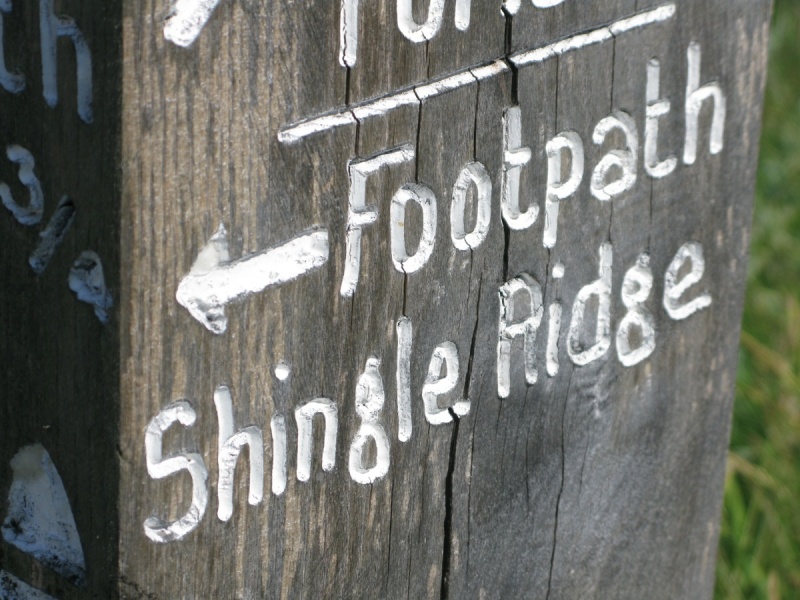
Please note that the South West Coast Path/public footpath no longer runs across Porlock Shingle Ridge from Porlock Beach to Bossington Beach. According to the Exmoor National Park Authority, it is permanently closed. 'Porlock Shingle Ridge is impassable due to the breach. Do not attempt to cross, even at low water. Follow signs from Bossington to Porlock Weir.' (Source: Exmoor National Park Authority website.)
When walking the area, you're directed through Porlock Marsh (National Trust) / Sparkhayes Marsh (National Trust) behind Porlock Shingle Ridge. This follows the South West Coast Path. The Welsh coastline is visible across the Bristol Channel. It's well signposted and a beautiful walk.
Historical and cultural attractions near Porlock Shingle Ridge
Porlock Weir Harbour. ‘Lying within the attractive Parish of Porlock, Porlock Weir with its whitewashed cottages, ancient inn and stone quay has a most picturesque setting. Although the tidal harbour now provides shelter only for pleasure craft, in the past cargoes including limestone, coal, timber and produce were shipped to and from South Wales and beyond.’ (Source: information board at Porlock Weir car park.)
Porlock and Coleridge’s ‘Kubla Khan’. Explore Porlock and you’ll see lines from the Romantic poet Samuel Taylor Coleridge’s ‘Kubla Khan’. Whilst Coleridge was writing ‘Kubla Khan’, he was interrupted by a ‘person on business from Porlock’ and the poem was never completed.
Coleridge Cottage (National Trust). Visit the cottage in which Coleridge lived and wrote some of his most famous poetry. William Wordsworth lived, briefly, nearby. Note that the cottage is in Nether Stowey on the east side of the Quantock Hills National Landscape.
The Ancient Mariner Sculpture in Watchet. The Watchet and Quantock Hills National Landscape area inspired Samuel Taylor Coleridge to write ‘The Rime of the Ancient Mariner’. Watchet is on the West Somerset coast to the east of Porlock Weir and Exmoor National Park.
Culbone Church. Said to be the smallest parish church in England, Culbone Church is located on the South West Coast Path as it runs west of Porlock Weir and Porlock Weir The Bottom Ship Inn. Wander up to the church and return for a pint.
Allerford Museum West Somerset Rural Life Museum and Victorian School.
Rowbarrows west of Dunkery Beacon. Explore some of Exmoor’s rich prehistory.
Doone Country. Richard Doddridge Blackmore's famous novel 'Lorna Doone' is set on Exmoor. Roughly speaking, Doone Valley/Doone Country runs south of Malmsmead and Oare along Badgworhty Water. It’s surrounded by high moor.
Watersmeet (National Trust). Wonderful National Trust property where Hoaroak Water joins the East Lyn River. Set in a steep-sided and heavily wooded valley, there’s a shop, tea room and garden on site. Watersmeet is part of the National Trust’s West Exmoor property covering ‘some 4000 acres (1600ha) of rocky cliffs, open moorland, steep wooded valleys and fast flowing rivers’. (Source: National Trust information board at Watersmeet.)
Lynmouth Harbour. Popular and pretty harbour between Lynmouth Western Beach and Lynmouth Eastern Beach on the Exmoor coast. Boat trips run from the harbour.
Lynmouth Pavilion National Park Centre. Visitor centre by Lynmouth Harbour.
Lynton and Lynmouth Cliff Railway. ‘The famous Lynton and Lynmouth funicular Cliff Railway opened in 1890 and is the highest and the steepest totally water powered railway in the world!’ (Source: Lynton and Lynmouth Cliff Railway website.)
Minehead Harbour. Harbour in stunning location at the western end of Minehead Beach under North Hill. ‘There has been a harbour at Minehead since the late 1300s.’ (Source: Minehead Harbour website.)
Dunster Castle (National Trust). Impressive National Trust property dominating the beautiful village of Dunster.
Dunster Yarn Market, Butter Cross and Gallox Bridge (English Heritage). English Heritage properties in Dunster.
Cleeve Abbey (English Heritage). Wonderful English Heritage property just east of Exmoor National Park.
The Ancient Mariner Sculpture in Watchet. The Watchet and Quantock Hills National Landscape area inspired Samuel Taylor Coleridge to write ‘The Rime of the Ancient Mariner’.
Coleridge Cottage (National Trust). Visit the cottage in which Coleridge lived and wrote some of his most famous poetry. William Wordsworth lived, briefly, nearby.
Other attractions near Porlock Shingle Ridge
Porlock Weir Submarine Forest. ‘At low tide it is sometimes possible to see the remains of a submerged forest on the beach. This dates from a time between 7000 and 8000 years ago, when due to climatic conditions the sea level was much lower and the area where the beach is today would have been woodland, and the shoreline several miles further north. The remains of prehistoric cattle called Aurochs have been found here and can be seen in Porlock Visitor Centre.’ (Source: information board at Porlock Weir car park.)
South West Coast Path. The Exmoor section of the South West Coast Path is particularly stunning.
Coleridge Way. Another amazing long distance walking path that runs across Exmoor.
Dunkery and Horner Wood National Nature Reserve. Explore one of England’s largest and most beautiful National Nature Reserves. We’d recommend walking around Horner Wood and then heading up to Exmoor’s highest point at Dunkery Beacon on Dunkery Hill.
Exmoor International Dark Sky Reserve. The night skies above Exmoor, Dartmoor and Bodmin Moor are all exceptional.
Places to eat near Porlock Shingle Ridge
Porlock Weir The Bottom Ship Inn. Pub overlooking Porlock Weir Harbour at the western end of Porlock Shingle Ridge.
The Porlock Weir Hotel. Next door to Porlock Weir The Bottom Ship Inn.
Bossington Kitnors Tea Room and Garden. Tea room in Bossington villages behind the eastern end of Porlock Shingle Ridge.
Porlock The Ship Inn. Pub in Porlock behind Porlock Shingle RIdge, Porlock Marsh (National Trust) / Sparkhayes Marsh (National Trust) and Porlock Ridge and Saltmarsh SSSI/Site of Special Scientific Interest.
Villages and towns near Porlock Shingle Ridge
Porlock Weir. Super popular West Country harbour village.
Porlock. Famous West Country village in Porlock Vale.
Bossington. Village by Bossington Beach below Bossington Hill.
Allerford village. Beautiful village further inland known for its packhorse bridge.
Selworthy village. One of the West Country’s prettiest villages, Selworthy is famous for its thatched cottages and village green. Enjoy a cream tea at the Periwinkle Tea Room.
Malmsmead and Oare. Hamlet and village in Exmoor’s Doone Country. Great walking. We’d recommend following the path that runs by Badgworthy Water to the site of the medieval village in Doone Country in the heart of the moor.
Lynmouth. Famous West Country village and part of ‘England’s Little Switzerland’.
Lynton. Again, famous West Country village and part of ‘England’s Little Switzerland’. Sits above Lynmouth and close to The Valley of Rocks.
Photo Gallery